We see a future where agricultural science, drone technology, and data analytics come together in
the form of a productive, efficient and cost effective process to solve numerous problems.
High-Resolution Crop Monitoring and Damage Assessment
Gain unparalleled insights into your crops with our advanced visual imaging services. Utilizing high-resolution cameras and sophisticated imaging technology, we provide detailed visual inspections and monitoring, allowing for precise crop management and early detection of potential issues.
Key Features
Damage Assessment
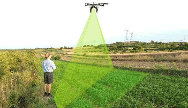
Identification and assessment of physical
damage to crops caused by storms, pest’s invasion, or other factors
Growth Monitoring
Tracking crop growth and development over time and seasons
Infrastructure Monitoring
Monitoring of agricultural infrastructure such as irrigation systems, greenhouses, and store facilities
Visual imaging provides high-resolution images for detailed visual inspection and monitoring
How It Works
1. Drone Deployment
Our hybrid drones are deployed to your fields, capable of both flying and driving.
Drones land and navigate the fields, collecting soil and crop data.
2. Data Collection
Soil probes and sensors gather data on soil composition, nutrient levels, and microclimatic conditions.
High-resolution cameras capture detailed images of crops for close-up inspection.
3. Analysis and Reporting
Advanced software processes the collected data to generate detailed reports.
Reports provide actionable insights on soil health, crop maturity, and microclimatic conditions.
Benefits:
Enhanced Soil Health: Identify and address soil nutrient deficiencies and composition issues.
Precise Crop Management: Gain detailed insights into crop health and maturity for optimized harvesting.
Improved Efficiency: Make informed decisions based on accurate ground-level data.
Reduced Costs: Optimize resource usage by targeting interventions where they are needed most.
Higher Yields: Enhance crop health and productivity through precise management practices.